


Despite the challenges of COVID-19, OKI (Ohio-Kentucky-Indiana Regional Council of Governments) has been working throughout the pandemic to produce innovative tools to improve the quality of life and the economic vitality of the region.
Following are summaries and links to our most recent maps and apps:
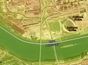
Ohio River Recreation Digital Guide
The Ohio River Recreation Digital Guide is a user-friendly, real-time resource and planning guide for anyone who wants to explore the Ohio River and the communities along its shore, whether by water or land. The guide identifies amenities such as marinas, boat ramps, fuel docks, campgrounds, parks, bike trails and historical points of interests on and along the Ohio River Recreation Trail’s (ORRT) 274-mile stretch, from Portsmouth, Ohio, to West Point, Ky.
The guide includes links to the websites of river communities, enabling travelers to explore lodging and restaurant options, as well as special events, history and other attractions of each town. The U.S. Coast Guard supports the guide, impressed with its focus on river and boater safety.
OKI EV Charging Station Locator
The OKI EV Charging Station Locator map can be used to find ideal locations for both level 2 and DC fast charging stations across the Greater Cincinnati Region. Simply enter an address or pick a location on the interactive map and the app returns a detailed EV Charger analysis of the location.
![]()
The analysis includes nearby traffic counts, amenities (malls, shopping centers & restaurants), the distance to the nearest EV charging station, the distance to the nearest EV alternative fuel corridor, the highest functional classified roadway within a quarter mile and a detailed map of the location.
OKI’s Urban Heat Island Map tool finds areas most impacted by the urban heat island effect. Since the cause of UHI are large parking lots and buildings, the most effective solutions for communities is to use zoning to minimize building footprints and the size of parking lots to the extent practical, then use/require shade trees in and around these structures to help mitigate the effect.
The map identifies the areas within a community that are currently most impacted, and what types of land use are associated with these “hot spots.”
OKI’s Fiscal Impact Analysis Model (FIAM) is a “new and improved” tool and a free service for scenario-planning designed specifically for local governments. It gives decision-makers a better understanding of the budgetary implications of land-use proposals.
The tool can help guide land use policy decisions; allow for an integration of land use and budget considerations; bring a realistic sense of the costs of growth into the public discussion; and gain an understanding of the likely demands for services and capital facility impacts.