


By Jack Brammer
NKyTribune reporter
A state Democratic Party official testified Tuesday that the new Republican-drawn maps of 100 state House and six Congressional districts severely harm his party in favor of Republicans and could affect his party’s ability to run statewide races.
Trey Hieneman, political director of the Kentucky Democratic Party, testified in the first of three days of scheduled hearings in Franklin Circuit Court to determine whether the boundary maps drawn by this year’s General Assembly are constitutional.
The Kentucky Democratic Party and Democratic voters in Franklin County filed suit against the new boundary maps in January, contending that they violated the Kentucky Constitution and amounted to “extreme partisan gerrymandering” that unfairly treats Democrats.

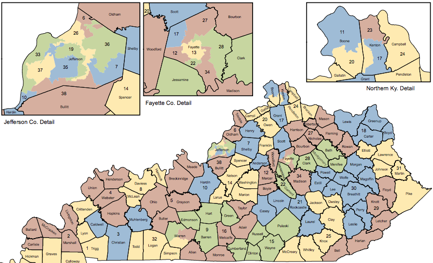
The lawsuit claims that 13 counties, including Campbell, and several cities, including Covington, were split too much.
Franklin Circuit Judge Thomas Wingate turned down a request in February by the Democrats to block temporarily the maps, saying it would throw the May 17 primary elections into disarray. He ordered a full hearing on the lawsuit.
In the first day of the hearing, state Democratic Party official Hieneman said he worked with his party on an alternative to the Republican proposal but lawmakers did not consider it.
The GOP maps have impacted candidate recruitment efforts by the Democratic Party, Hieneman said.
Several candidates were drawn out of their districts and could not run, he said, and some districts became more Republican in voter registration, dissuading Democratic candidates not to run.
He said only 57 of the state 100 House districts are contested this year, compared to 77 in 2020.
Hieneman noted that numerous splits in some areas of the state diluted Democratic districts.

Covington split into three House districts
He specifically mentioned Covington. The new maps split the city into three state House districts instead of one.
The 65th House district, represented by Rep. Buddy Wheatley, D-Covington, is now 10 percent more Republican instead of 10 percent more Democratic, said Hieneman.
Hieneman also said the new maps could affect the Democratic Party’s ability to run statewide races by curtailing contributions to the party.
Victor Maddox, associate attorney general representing the defendants, Secretary of State Michael Adams, and the State Board of Elections, indicated that the Democratic Party’s struggle to recruit candidates could have been eased if Democratic Gov. Andy Beshear had called a special legislative session last year to address redistricting.
Beshear declined to do that, saying he would not call a special session until he saw the legislature’s redistricting plan.
Also testifying Tuesday for the plaintiffs was Kosuke Imai, a professor in the Department of Government and the Department of Statistics at Harvard University.
Imai specializes in the development of statistical methods for and their applications to social science research. He analyzed data about the new Kentucky district maps.
He said Tuesday that the new House map creates additional safe Republican districts by unnecessarily splitting county boundaries to include many Republican voters from neighboring counties.
He also said the new 1st Congressional District, which runs all the way from far Western Kentucky to Franklin County is “unusually non-compact.”
The new Congressional map was a nod to U.S. Rep. James Comer, R-Tompkinsville, whose family home is in Franklin County.
The attorneys for the state peppered Imai with questions to show how little he knows of Kentucky politics.
He was asked about several controversies in the administration of former Gov. Matt Bevin.
That prompted Judge Wingate to ask, “Did you know that Matt Bevin attacked a very prominent judge here in Franklin County?”
He was referring to Franklin Circuit Judge Philip Shepherd, who is being challenged this year by Joe Bilby.
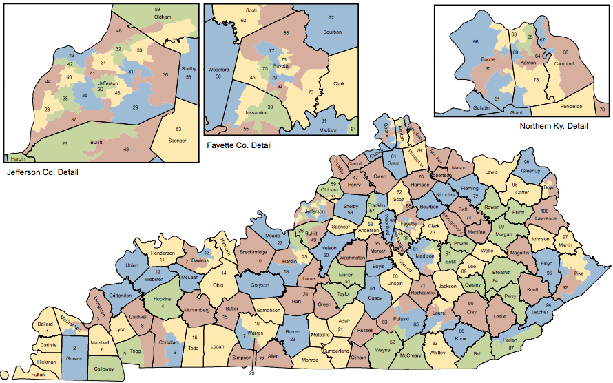
Kentucky Senate Redistricting map:
Kentucky House Redistricting map: