


Staff report
As they say, if you don’t like the weather, just stick around. It’s bound to change.
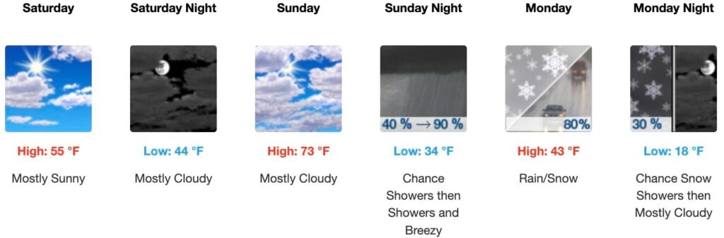
It will be sunny today and mostly cloudy on Sunday with a high near 73 degrees. . .But a severe weather event is expected to affect Kentucky Sunday night into Monday, according to the National Weather Service (NWS), with high winds and possible tornadoes, followed by cold temperatures to start the new work week.
And maybe a bit of snow Monday.
A cold front is coming in that’s going to bring gusty Southwest winds of 40-50 miles per hour. Then, we’re going to have a strong cold front move through.
The main threat is going to be damaging straight line wind gusts up to 70 miles per hour, especially at night.
Other hazards are also possible, according to the National Weather Service, including some spin-up tornadoes of up to 110 to 135 miles per hour.
Stay weather aware during these times, especially, since it will be a nighttime event in much of the state. Make sure your phones are charged and you have ways to receive weather alerts.
After the front passes through, that won’t be the end of bad weather. Temperatures will drop, starting early Monday morning and it’s downhill from there.
And to show Winter isn’t over, there could be more snow on Wednesday.
Once we get through Wednesday, temperatures will rebound and are forecast to return to the 60s for Thursday and Friday.
Be prepared is the advice for the week.
Can’t wait for Spring, right?