By Margo Warminski
Special to NKyTribune
Part 22 of our series, “Resilience and Renaissance: Newport, Kentucky, 1795-2020”
“Newport’s social structure would also change fundamentally. A prosperous, old-stock, Protestant, river town would evolve into an immigrant, heavily Catholic, working-class city” (Thomas L. Purvis, et al., eds., Newport, Kentucky: A Bicentennial History. Newport, KY: Otto Zimmerman & Son, 1996, p. 53).
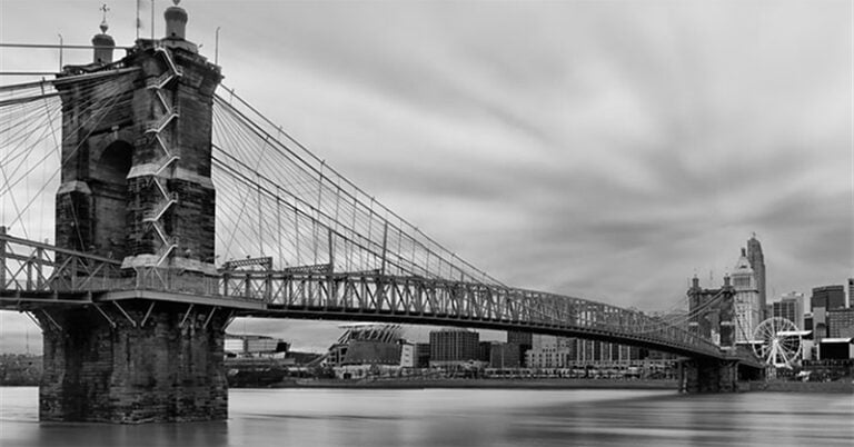
The city of Newport was founded in 1790, making it the oldest of Northern Kentucky’s river towns. Newport’s founder, General James Taylor of Virginia, recognized his town’s potential, given its location at the confluence of the Ohio and Licking rivers opposite Cincinnati, where immigrants flooded in the 19th century. Newport undoubtedly benefited from its larger neighbor’s growth as a market for goods, and some of this burgeoning population ended up relocating to the south side of the river.
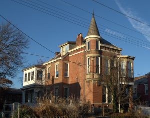
As Newport’s economy grew in the mid-1800s, the city literally ran out of space. Rapid industrialization called for more housing lots to accommodate the city’s recent growth. “The accelerating pace of industrialization during the 1840s trapped the city within extremely constricted limits” (Purvis, p. 71). In response to industrial expansion, the 1840s saw the biggest construction boom in Newport’s history. Its population expanded by 413% in that decade, and it was elevated by the state legislature to city status in 1849. By 1850, Newport had absorbed so many immigrants that the majority of its adult population came from foreign countries” (Purvis, p. 75).
To accommodate this growth, Newport’s boundaries were expanded for the first time since its founding. From 1845 to 1850, its land area grew by two-thirds as it pushed to the west and south. “About 1846, General Taylor surveyed 750 lots” between Monmouth and Central (formerly, Cabot Street) and from current-day Eighth Street (formerly, Ringgold) south to Twelfth Street (formerly, Liberty). “He named the tract after the remarkable victory just won by his cousin Zachary Taylor’s badly outnumbered army against Santa Anaa in the Mexican War” (Purvis, p. 72).
“When James Taylor, Sr., died in 1848, he left another 120 acres of this property along the Licking to be laid off into lots as a further addition to Newport. Since it bordered Buena Vista this area also became known by that name. The General directed that this tract neither be subdivided at one time, nor hurried into sale, so it developed gradually as part of the West End during the late 19th century” (Purvis, p. 73).
“Buena Vista would be an area of high population density, because the vast majority of its lots measured just one fourteenth of an acre, equivalent to a population density of about 18,500 persons per square mile….” (Purvis, p. 72). The small lots of Buena Vista were attractive to working people, who saw the opportunity to purchase them and build modest homes, often with the aid of church-based savings associations. “Local savings associations served as intermediaries in the purchase of a lot and the building of a home…. Such arrangements were also conducted within churches, particularly those with large immigrant populations” (Don DeBats, “Newport Home Ownership,” in Tenkotte and Claypool, eds., The Encyclopedia of Northern Kentucky, p. 657).
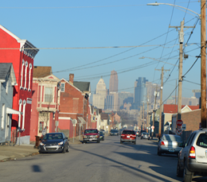
Despite the activities of Newport’s building associations, however, most city residents did not own their own homes. Twenty-two percent shared a dwelling with another household and the average number of persons per dwelling in 1880 was 6.3, which would drop slightly to 5.8 by 1900 (Purvis, p. 115). The new neighborhood also included some larger, quarter- and half-acre lots between Eighth and Ninth streets, which would attract more affluent owners and public servants.
Sanborn Fire Insurance maps of Newport chart the development of Buena Vista in the late 19th and early 20th centuries. The 1886 edition depicts the area between York Street, Central Avenue, Eighth Street and Twelfth Street as nearly completely developed, with only scattered parcels still vacant. Numerous industrial buildings occupied the blocks from Brighton Street to the Licking River, indicating the extent of industrialization in the neighborhood, particularly along the river (Sanborn Map Publishing Company, Newport, Kentucky, 1886).
Eight years later, the 1894 Sanborn map shows development of lots between Brighton and Lowell was well underway, as were two major industrial complexes west of Lowell: the Newport Rolling Mill (no longer extant) and the powerhouse for the Cincinnati-Covington-Newport Street Railway (later known as the South Covington & Cincinnati Street Railway), which still stands (Sanborn-Perris Map Company Limited, Covington, Newport, et al Sanborn-Perris Map, 1894). By 1910, the development of the neighborhood was nearly complete, including the southwest section between Brighton and Lowell. The street railway facility had been expanded with the addition of the car barn at Brighton and Eleventh Streets (Sanborn Map Company, 1910).
Despite these successes, life was not always easy in Buena Vista. A low-lying neighborhood, it was susceptible to flooding, and three successive inundations deluged the community in the early 1880s. As new neighborhoods on higher ground farther east developed in the late 19th century (present-day Mansion Hill and East Newport historic districts), those with means began to relocate there to escape flooding, marking the beginnings of gradual disinvestment in Buena Vista. In the winter of 1937, the Ohio would swell to 80 feet above flood stage, rising nearly to the second stories of buildings in Buena Vista. The situation was made worse by the depressed economy.
In the years after World War II, Newport, and Buena Vista in particular, experienced a significant demographic shift. Many longtime residents, largely Roman Catholic, took advantage of federally supported incentives for suburban development and moved to outlying suburbs such as Fort Thomas and Highland Heights. Taking their place were migrants from Appalachia, thousands of whom were forced out by the mechanization of coal mining in their home counties (Paul H. Rakes, “Coal Mine Mechanization,” e-WV: The West Virginia Encyclopedia).
“Large number of Appalachians joined the United States military to fight in both world wars and this exposure to the larger world emboldened them to move to industrial cities, including Covington and Newport, in search of employment. During World War II, the war industries of Northern Kentucky, including Newport’s massive steel mills…actively recruited workers….
“As longer-established ethnic groups, such as German-American and Irish Americans, departed the cities of Newport and Covington for outlying suburbs, Appalachian migrants took their place. For example, after World War II, the West End of Newport changed dramatically, as German and Irish families moved to Fort Thomas and beyond and were replaced by migrants from Appalachian Kentucky, who accepted jobs in the steel mills of Newport” (Karen Claiborne, “Appalachians,” in Tenkotte and Claypool, eds., pp. 33-34).
Seeking to assist these new residents, in 1966 a Catholic priest named Rev. William Neuroth founded a settlement house in Buena Vista called Brighton Center. The agency took its name from its location in an abandoned storefront at Eighth and Brighton Streets. The center offered a combination of Christian witness, educational activities, recreation and social services and is still in operation today on a new site (Jeanne Greiser, “Brighton Center,” in Tenkotte and Claypool, p. 119).
Long an industrial powerhouse, Newport’s economic might declined in the post-World War II era, as happened in many cities. Deindustrialization and corporate consolidation resulted in job losses and declining tax revenue. Ongoing suburban growth and the construction of interstate highways, which ripped through neighborhoods, led to center-city population decline, and Newport became a smaller, poorer city.
While Buena Vista remained a healthy neighborhood for many years, like the larger city, it was susceptible to socioeconomic trends that undermined its stability. As years passed, it began to suffer from disinvestment, poverty and crime, all of which continue to trouble the community to this day. The growing number of vacant, blighted homes confounded city planners: Was old-style urban renewal the answer? Low-cost infill housing?
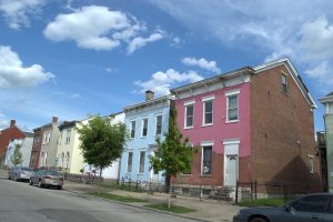
In a new century, however, new answers presented themselves. As the millennial back-to-the-city movement took hold in Northern Kentucky, housing prices soared in East Newport. Priced out of the market, young people, first-time buyers and risk-takers looked to Buena Vista as an affordable, adventurous alternative.
Neighborhood Foundations, Newport’s community development corporation, bought small homes and cottages that at one time may have been demolished and renovated them for low- and moderate-income families, using grant funds. They also built new Victorian-style townhomes for the same clientele on vacant lots. Kentucky Route 9, which follows the Licking, was widened and improved as a shortcut to I-275, attracting businesses to locate nearby.
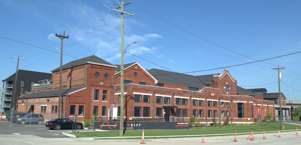
Commercial developers saw new opportunity in the neighborhood that drew captains of industry a century before. On Ninth Street, the former steel mill office was renovated as office space. A block away on Brighton Street, the former streetcar barn became the new home of a commercial contracting firm. On Lowell Street, the sprawling streetcar powerhouse became a distillery, brewing gold-medal bourbon with pure water from the aquifer below.
In the 21st century, the Newport Historic Preservation Office seized the opportunity to apply for a grant to photograph and document the neighborhood’s historic properties as the first step toward National Register district listing. The monumental project was completed in 2018 with the assistance of resident volunteers and community leaders Michael and Catherine McElwain. The City then applied for and received a grant to nominate the section bounded by Eighth, York, the railroad tracks and Lowell Street to the National Register of Historic Places. In the summer of 2019, the City received an award from the Kentucky Heritage Council, the state historic preservation office, for their work. The Buena Vista Historic District was officially listed in the Register on February 13, 2020, the seventh district in Newport to be so honored.
Margo Warminski is Preservation Director for Cincinnati Preservation Association, a position she has held since 2004. She is a native of Detroit with lifelong interests in urban living and historic architecture, particularly buildings that tell the stories of ordinary people. Margo has written numerous National Register nominations and has contributed to several books. She is presently restoring a house in Bellevue’s Taylors Daughters Historic District that came close to being demolished.
We want to learn more about the history of your business, church, school, or organization in our region (Cincinnati and Northern Kentucky). If you would like to share your rich history with others, please contact the editor of “Our Rich History,” Paul A. Tenkotte, at tenkottep@nku.edu. Paul A. Tenkotte, PhD is Professor of History at NKU (Northern Kentucky University) and the author of many books and articles.


