











By Tom Latek
Kentucky Today
The National Oceanic and Atmospheric Administration has issued the winter outlook for the period December through February and says the ongoing major El Nino event will be a key player in what we experience.
Thus far this year, El Nino has helped lead to more hurricanes developing in the Pacific Ocean, while suppressing them in the Atlantic, Caribbean and Gulf areas, so there has been only one, as of Wednesday. The last year there was only one hurricane in the Atlantic basin was in 1925, which was long before the age of radar and satellite imagery.
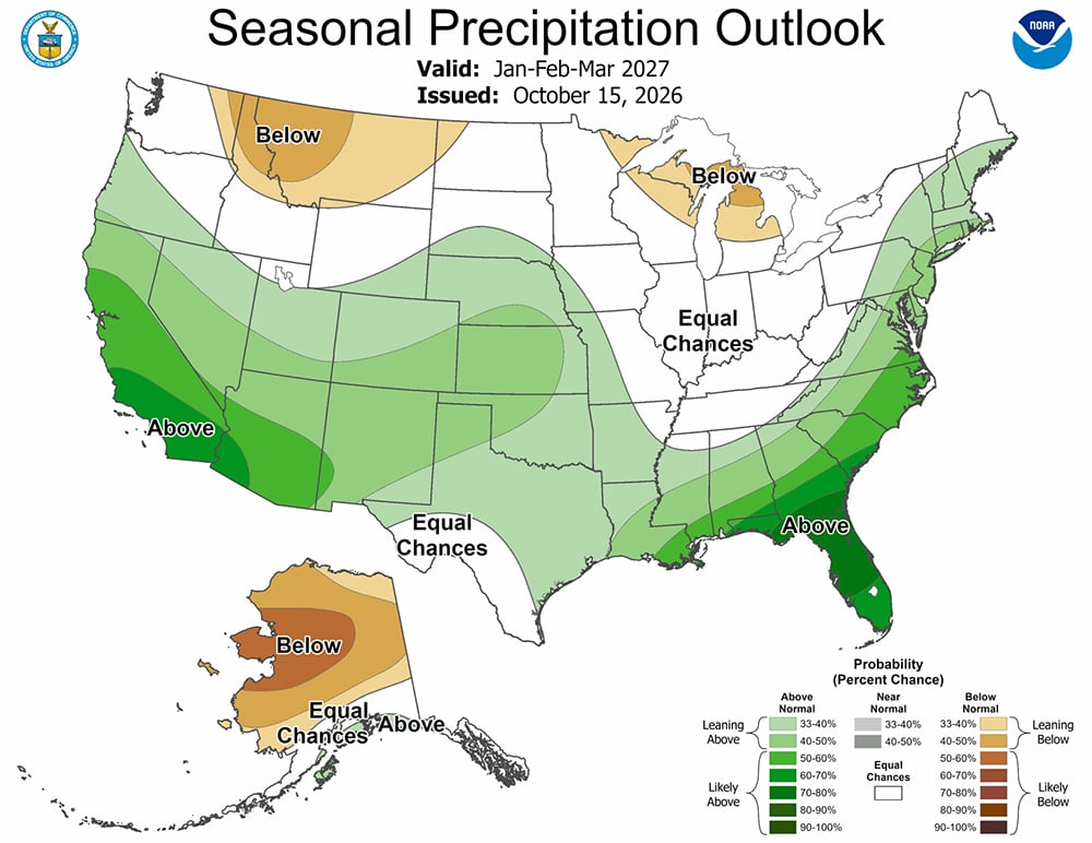
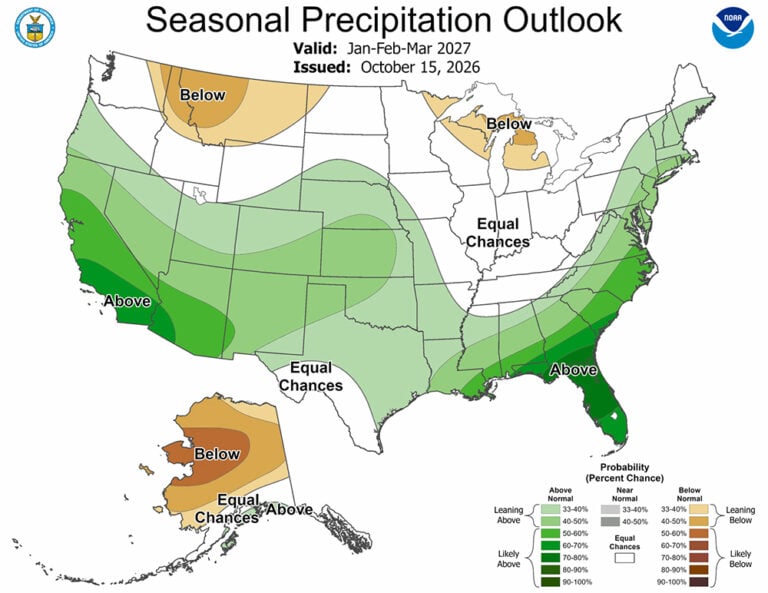
NOAA’s winter outlook shows how El Nino will likely influence the upcoming winter months (December 2026 to February 2027), with warmer-than-average temperatures expected across the northern U.S.; wetter-than-average conditions likely across the southern U.S., from California to Florida, and along the Eastern Seaboard; and drought improving for the majority of the country, including areas in the East, Southern Great Plains and Southwest.
“As we know from decades of observations, a very strong El Nino will likely bring a southward and eastward shift to the jet stream for the contiguous U.S., which tilts the odds toward stormier weather across the South,” said Ken Graham, director of NOAA’s National Weather Service. “While higher chances of rain and snow may bring relief to drought-afflicted areas, too much precipitation on dry soil can fuel destructive flash floods and mudslides. Now is the time for communities and individuals to plan ahead for the upcoming winter.”
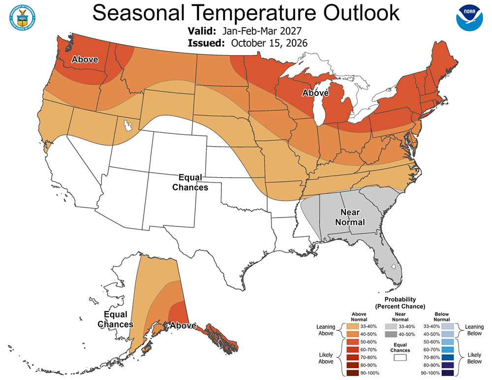
Specifically in Kentucky, the outlook calls for a 40 to 50 percent chance of warmer than normal temperatures, with a 33-40 percent chance in the far Southwest, which NOAA calls leaning above normal. Precipitation has an equal chance of being drier or wetter than normal. See the maps that accompany this story.
NOAA also has two new winter weather tools for the upcoming season.
The Probabilistic Precipitation Portal enables people to view the low-end, expected, and high-end amounts of snow, ice and rain, as well as the probabilities of precipitation exceeding specific thresholds.
Forecasters will also use “Particularly Dangerous Situation” wording in select Blizzard Warnings and Ice Storm Warnings this season. This will help forecasters alert the public about blizzards or ice storms which can pose imminent danger to life and disruptions to emergency services.
Visit weather.gov for local forecasts, watches, advisories and warnings, year-round.